WaBis
walter.bislins.ch
Rainy Lake Experiment: Location Graph and Data
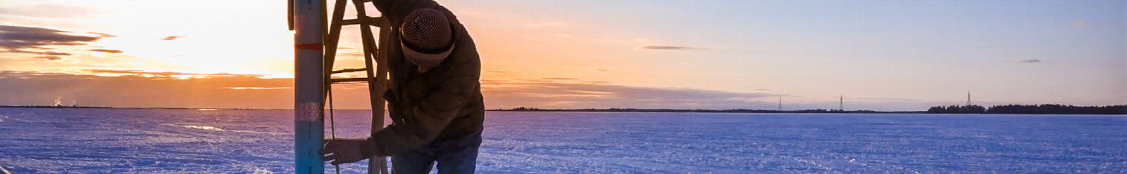
This page lists all data of the Rainy Lake Experiment. The following Graphs and Tables are just generated with JavaScript from the original GNSS data acquired by Jesse Kozlowski, see Measuring the Targets.
 Download Original Data
Top View
The numbers in parenthesis are labels for the targets. (0) is the observer location. Grid Spacing 1000 m × 1000 m.
Side View 1
All heights normalized to water level at observer by subtracting the water level height of data point (0) from all elevations. Grid Spacing 1000 m × 1 m.
The GPS vectors of the filled markers were measured using Differential GPS equipment. All vectors of the blank markers were derived from the GPS vectors at the same location and the measured target plate center heights using a measuring tape, see Measuring the Targets.
Side View 2
All heights normalized to water level at the individual target by subtracting the water level elevation at a target from all other elevations at a target. Grid Spacing 1000 m × 1 m.
The GPS vectors of the filled markers were measured using Differential GPS equipment. All vectors of the blank markers were derived from the GPS vectors at the same location and the measured target plate center heights using a measuring tape, see Measuring the Targets.
Obtaining Elevations
The suface of the earth can roughly be approximated by an ellipsoidal shape, the so called Reference Ellipsoid. We can express any location in the vicinity of the earth, even below or way above the surface, in Earth Centered Earth Fixed (ECEF) coordinates, as directly obtained from GNSS receivers, or by latitude, longitude and ellipsoid height. Transforming back and forth between ECEF coordinates and latitude/longitude and ellipsoid height is only a matter of geometry.

Maps and navigation devices express the third dimension not as height above the Reference Ellipsoid, but as Elevation.
The Elevation of a geographic location is its height above or below a fixed reference point, most commonly a reference Geoid, a mathematical model of the Earth's mean sea level as an equipotential gravitational surface.
The Geoid is the shape that the ocean surface would take under the influence of the gravity and rotation of Earth alone, if other influences such as winds and tides were absent. This surface is extended through the continents (such as with very narrow hypothetical canals). It is the "mathematical figure of the Earth", a smooth but irregular surface whose shape results from the uneven distribution of mass within and on the surface of Earth. It can be known only through extensive gravitational measurements and calculations. The Geoid has no geometrical relation to the surface of the ellipsoid.
To obtain ones Elevation, a raw GPS reading must be corrected. Modern GPS receivers contain a database of the Geoid heights (EGM96) with respect to the WGS84 Reference Ellipsoid. So they are able to correct the height above WGS Ellipsoid to the Elevation above WGS84 Geoid.
The shape of the Geoid is often approximated by spherical harmonics coefficients. The current best such set of spherical harmonic coefficients is EGM96 (Earth Gravitational Model 1996), determined in an international collaborative project led by the National Imagery and Mapping Agency (now the National Geospatial-Intelligence Agency, or NGA).
There are many Geoid models, that differ only in some cm. All Elevations used and displayed in the Rainy Lake Experiment are derived from the GEOID12B Geoid model used in North America.
- You can Download the GEOID12B database from the NGS website.
- You can Compute a GEOID12B geoid height for a specific location on the NGS website.
GNSS ECEF, Elevation and Geoid Data
The following table shows the GPS Vectors in Earth Centered Earth Fixed (ECEF) cartesian (x,y,z) coordinates, the Elevation and the Geoid height for the locations.
The ECEF coordinates are calculated by the GNSS receiver from the measured distances to the satellite locations in view by Multilateration.
The Elevation is calculated from the Reference Ellipsoid height and Geoid height as follows:
- Elevation = Ellipsoid height - Geoid height
The Ellipsoid height, together with latitude and longitude, is calculated with the WGS84 Calculator from the measured x,y,z ECEF coordinates (see GNSS Ellipsoid and Height Data). The Geoid height is optained as described at Obtaining Elevations.
Note: Elevations of water levels with respect to the Geoid vary about 336.909±0.044 m only. That is within the accuracy of the measurement of about ±5 cm. The Geoid height is 25.1 cm lower at the far end than at the observer locations with respect to the reference ellipsoid.
Rainy Lake Elevation WGS84 google earth is 338 m. Google Earth elevation data extraction and accuracy assessment for transportation applications, a study from 2017, reported road elevation accuracies of ±2.27 m.
GNSS Ellipsoid and Height Data
The GNSS data in the following table is converted from the ECEF data into latitude, longitude and ellipsoid height using the WGS84 Calculator. The calculated elevations and geoid heights are listet in the table GNSS ECEF, Elevation and Geoid Data above.
- hEll [m]
- ellispoid height calculated from ECEF data
- hRef [m]
- ellispoid height minus water ellipsoid height at reference point (ID = 0)
- hW [m]
- ellipsoid height minus water ellipsoid height at this location
- ElevW [m]
- elevation minus water elevation at this location
Target Positions and Sizes relative to the Observer
The following values are used in the Computer Model . The values are calculated from the GPS Vectors shown in the table at GNSS ECEF, Elevation and Geoid Data. The calculations are described at Create Computer Model Data.

The values represent the locations of water level at the observers and targets in a local coordinate system with origin at observer (0) and direction to the target (6).
| ID | Target [Typ] | Dist | Dmean | Ddiff | Side | Hcalc | Href | Hwater | Sizecal | Sizereal |
|---|---|---|---|---|---|---|---|---|---|---|
| 111 | (0) Obs Tang | -26.31 | 0 | -26.31 | +1.31 | 3.912 | ||||
| 1001 | (0) Obs Bedf | 0 | 0 | 0 | 0 | 1.854 | ||||
| 203 | (1) Bedf [0] | 1094.72 | 1051.02 | +43.70 | +1.09 | 1.854 | 1.815 | 1.842 | (0.120×0.185) | 0.55×0.22 |
| 204 | (2) Bedf [1] | 2168.50 | 2102.04 | +66.46 | +1.46 | 1.854 | 1.841 | 1.854 | 0.238×0.366 | 0.24×0.37 |
| 304 | (2) Tang [1] | 4.218 | 4.267 | 4.280 | 0.238×0.366 | 0.31×0.47 | ||||
| 205 | (3) Bedf [1] | 3233.97 | 3153.07 | +50.90 | -3.22 | 1.854 | 1.812 | 1.845 | 0.356×0.547 | 0.36×0.55 |
| 206 | (4) Bedf [1] | 4363.27 | 4204.09 | +159.18 | -2.72 | 1.854 | 1.824 | 1.863 | 0.479×0.737 | 0.48×0.74 |
| 306 | (4) Tang [1] | 5.151 | 5.1231) | 5.162 | 0.479×0.737 | 0.56×0.86 | ||||
| 208 | (5) Bedf [1] | 5433.70 | 5255.11 | +178.59 | -2.48 | 1.854 | 1.732 | 1.842 | 0.597×0.918 | 0.60×0.92 |
| 209 | (6) Bedf [2] | 6428.94 | 6306.13 | +122.81 | 0 | 1.854 | 1.673 | 1.854 | (0.706×1.086) | 1.30×0.46 |
| 309 | (6) Tang [2] | 6.602 | 6.6962) | 6.877 | (0.706×1.086) | 1.30×0.46 | ||||
| 16 | (7) Tang [1] | 9459.20 | 9459.20 | 0 | -1.76 | 9.740 | 10.535 | 10.773 | 1.039×1.599 | 1.04×1.60 |
- Target [Typ]
- There are 3 types of targets labeled 0 to 2. The Sizereal specifies type dependent the width or height of the target, which ever is the greater value.
- Dist [m]
- is the distance of the target from the observer as calculated from the GPS ECEF data providet by Jesse Kozlowski.
- Dmean [m]
- is the mean distance between the targets as used in Dist and DeltaDist in the Computer Model . It is the distance of the last target dividet by the 9.
- Ddiff [m]
- is the distance correction applied to the mean distances of a target in the App to place the targets at the right locations.
- Side [m]
- Is the side offset of the targets from the line of sight as computed from the GPS ECEF data via the WGS84 Calculator. You can set this value to 0 by moving the SideVar slider on the Object 1 panel to the left or right.
- Hcalc [m]
- is the calculated ideal target center height. The lower targets are placed at 1.854 m = (73") while the upper target center heights are calculated in such a manner, that they all lie on eye level of 3.912 m, applying standard refraction 0.17 and assuming a spherical earth with radius 6371 km, see Calculating Tangent Target Heights. The App uses this heights if on the Object 2 panel the SizeVar slider is at 0.
- Href [m]
- is the GNSS measured target ellipsoid height minus the measured water ellipsoid height at the reference point (ID = 0). The App uses this heights if on the Object 2 panel the SizeVar slider is at +100%.
- Hwater [m]
- is the GNSS measured target ellipsoid height minus the ellipsoid height of the water level at the target position. The App uses this heights if on the Object 2 panel the SizeVar slider is at -100%.
- Sizecal [m]
- If all target were of Typ 1, this size ensures that all targets appear the same size, no matter at which distance from the obserever. For Typ 0 and Typ 2 targets, the size is measured from video footage. See Calculating Target Size.
- Sizereal [m]
- Is the size of the targets as used in the App. For some targets I got the size from George's videos. Note: you can set the target size for all targets to 0.8 if you set the SizeVar slider in the Object 1 panel to +/-100%. In this case the target sizes appear to shrink with distance.
Adjustments of the Tangent Target Heights
The Tangent Target were not mounted to exactly the pre-calculated heights. They were mounted to optically align with eye level of the observer. This was done for each target separately at different days, and hence at different refractions conditions. So the GPS measured heights for the Tangent-Targets (4) and (6) differ from the heights on the images. To match the images the Computer Model uses height values optained from the images rather than the measured heights for this targets. The differences between GPS measurement and optical measurement from the images lie within the height variations due to common refraction variation.
1) Due to the different times where the measurements and images were taken, the height of the target (4) on the image diverges from the GPS measured height. The App uses 5.24 m derived from the image instead of the measured 5.123 m.
The correction of +12 cm applied to the target (4) height is small compared to the target size of 86 cm and an apparent refraction height variation of about ±15 cm for a variation of the refraction coefficient of k = ±0.1. This correction does not affect the outcome of the experiment.
2) Due to the different times where the measurements and images were taken, the height of the Tangent-Target (6) on the image diverges from the GPS measured height. The target is broken on some images, so I applied two different correctons: The App uses 6.2 m for the broken height and 6.5 m for the upright height, instead of the measured 6.696 m.
The correction of −49.6 cm applied the broken target and −19.6 cm for the upright target is small compared to an apparent refraction height variation of ±32 cm for a variation of the refraction coefficient of k = ±0.1. This correction does not affect the outcome of the experiment.
If the SizeVar slider in the Objects 1 panel is set to 0, then the broken version of the Tangent-Target (6) is drawn. If the SizeVar slider is set to 1, then the upright version of the Tangent-Target (6) is drawn.
Geoid Variations and Computer Model
The Bedford Targets were set exactly 1.85 m above the lake water level. In the table above are the target center heights Href listed as used by the computer model.
Due to variations in the gravitational field, expressed by the Earth Gravitational Model (EGM96 Geoid), see Obtaining Elevations, the elevation of the water surface at the last target (7) is 25.1 cm lower than the elevation of the water surface at the observer. The computer model does not take the Geoid variations into account. To simulate the exact geometrical 3D positions of the targets, all target center heights were adjusted for a sphere by using the ellipsoid heights of the targets with respect to the ellipsoid height at the observer. This results in the reduced target center heights shown in the table above. Using this adjustments the target images of the computer model match the observation perfectly, while the horizon appears 23.8 cm too height on the computer model, because it does not model the surface drop of 25.1 cm of the Geoid.