WaBis
walter.bislins.ch
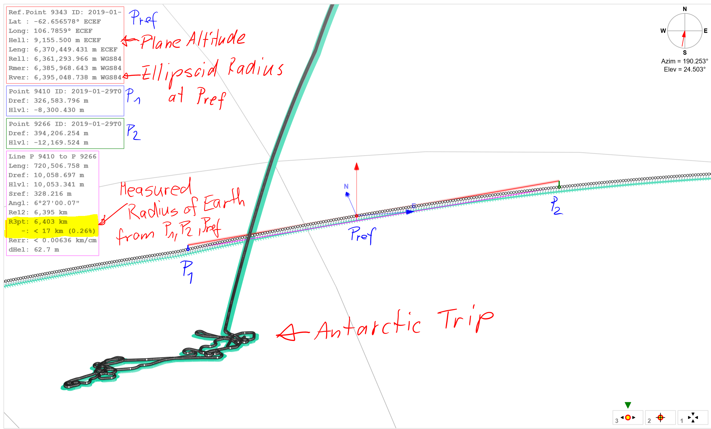
Bild: 2019-02-26_GS_Trip_measuring_radius_of_earth.PNG
 2019-02-26_GS_Trip_measuring_radius_of_earth.PNG
Visualisation of GPS data recorded on the flight of Greater Sapiens around the earth including a trip to Antarctica. You can see all data in my Display Geo Data App. Here is shown how the radius of the earth is measured with the App by selecting 3 points in a row with the same altitude above sea level.

The ellipsoid radius at this location is 6395 km, the altitude of the plane is about 9 km. So the expected radius from 3 points should be 6404 km. We get a value of 6403 km from the arc between the 3 selected points.